Sept 2009 Geology River Trip - Day 10 Sept 22 from Spencer Canyon RM246 to Lake Mead (and back to Flag)
Day 10 from Spencer Canyon to Lake Mead (past mile 277 to around 300) and back to Flag
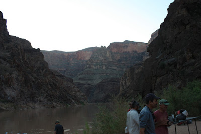
06:38 Last Breakfast in the Canyon for 2009 river trip
0638LastBreakfastInCanyon_gc9i_001249.jpg
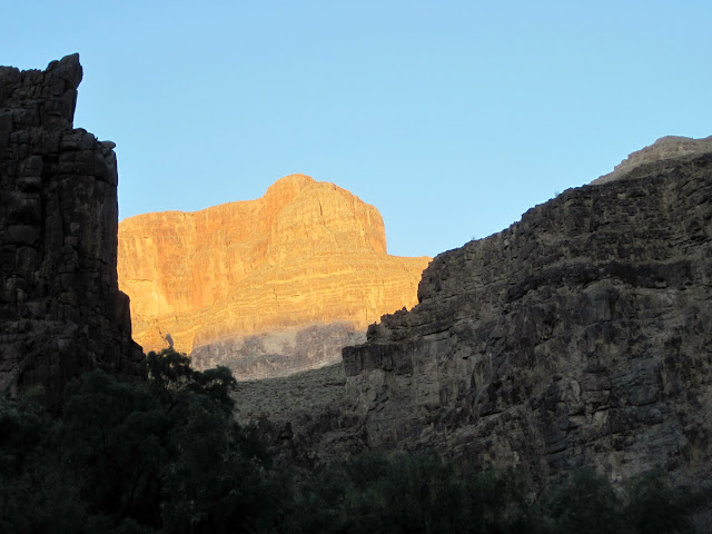
06:43 Sunrise
0643LastSunrise2009GCtrip_IMG_1935.jpg
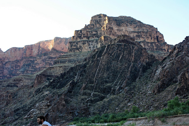
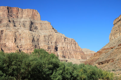
07:18After our final “Load the Boat” we head on downriver
0718StartingDOwnRiverGreatScenery_gc9i_001250.jpg
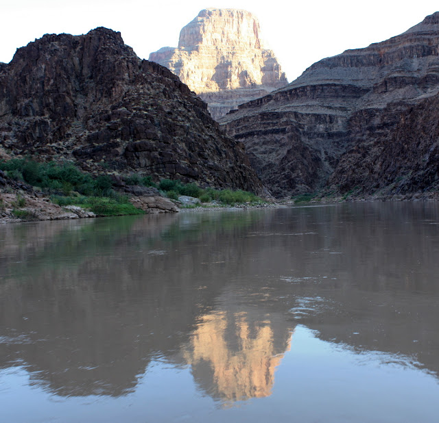
07:28 Reflecting on our last day AM Reflection
0728WeReeflectOnFinalAMReflection_gc9i_001261.jpg
08:46 Heron poses on sandbar
0846HeronPosesOnSandbar_gc9t_001685.jpg

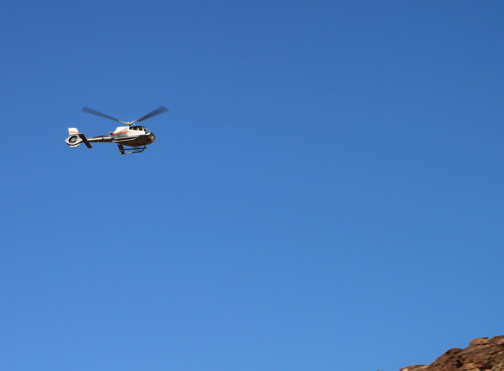
Lots of chopper traffic today – quite noisy
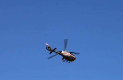
08:51
0851Chpper1_gc9t_001689.jpg
08:52
0852Chpper2_gc9t_001692.jpg

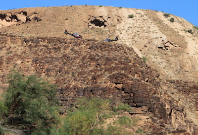
08:54 chopper hangout
0854Chopper3Hangout_gc9t_001693.jpg
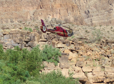
09:27 another chopper spot
0927Chopper4_IMG_1953.jpg
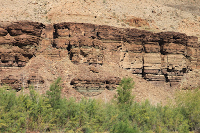
09:40 BA Shale
0940BAShale_gc9t_001703.jpg
09:46 Lake Mead deposits appear – note how eroded they are by lowered river channel – lake extended hundreds of yards to either side of current lower channel
0946LakeMeadDepositsDrodedBelowLimestoneCliffs_gc9t_001704.jpg

09:47 Side Canyon along one of many faults we cross today
0947SideCanyonAlongOneOfVariousFaultsWePass_gc9t_001705.jpg
09:48 BA Shale below Dolomite - detail
0948BAShaleExposureDetailBelowDolomite_gc9t_001706.jpg

09:51 Sky Bridge becomes visible up side canyon
0951SkyBridgeUpSideCanyon_gc9t_001720crop.jpg

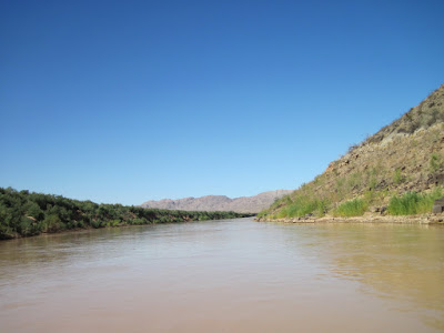
11:03 Rounding last bend in canyon we see . . .
1103RoundingLastBendsWeRunOutOfCanyon_IMG_2020.jpg

11:20 we run out of canyon past Grand Wash cliffs
1120PastEndOfCanyon_IMG_2037.jpg
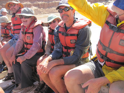
12:02 Jetboat is just ahead – a couple final shots on the raft – 1
1202Group1AlmostDone_IMG_2045.jpg

12:02 number 2
1202Group2AlmostDone_IMG_2047.jpg
Number 3
1203Group3AlmostDone_IMG_2048.jpg

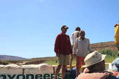
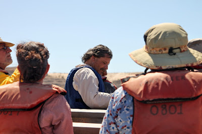
Number 4 we bid farewell to our guides
1212Group4AlmostDoneUnloadTheBoat_gc9t_001804.jpg
12:12 In jetboat
1212InJetboat2_IMG_2050.jpg

12:13 casting off from Canyoneers raft
1213CastingOffFromCanyoneersRaft_IMG_2052.jpg

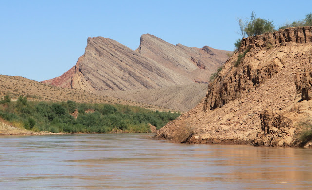
12:16 highly tilted strata typical of Iceberg Canyon – mostly Cambrian (rising up to Permian Toroweap and Kaibab)
1216HighlyTiltedStrataTypicalOfIcebergCanyon_gc9t_001811.jpg
12:20 looks like jetboat is headed straight towards a collision
1220JetboatMeetsCambrianStrata_gc9t_001816.jpg
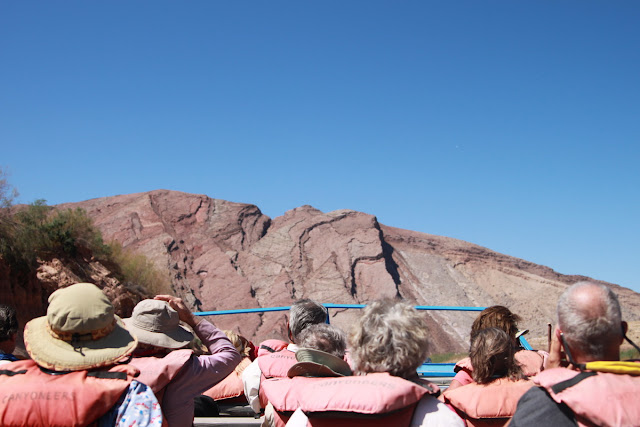
12:29 panorama of tilted strata
1229PanoTiltedCambrianStrata_gc9t_001870.jpg

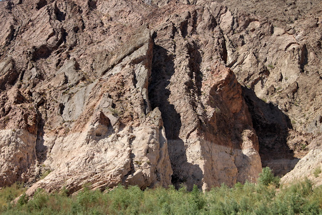
12:32 detail of iceberg canyon strata – note the bathtub ring where Lake Mead has dropped
1232DetailTiltedSTrataNoteBathTubRing_gc9t_001887.jpg
12:32 soon we run out of canyon and see Lake Mead open up ahead
1232LastPartCanyonLakeMeadAhead_gc9t_001888.jpg

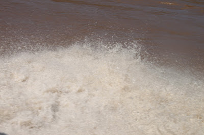
12:38 there is just one last rapid; one big splash (and a big bang!)
1238OneBigSplashBigBangInLastRapid_gc9t_001904.jpg
12:40 ending a great trip
1240EndingGreatTrip_gc9t_001914.jpg

1240EndingGreatTrip2_gc9t_001915.jpg
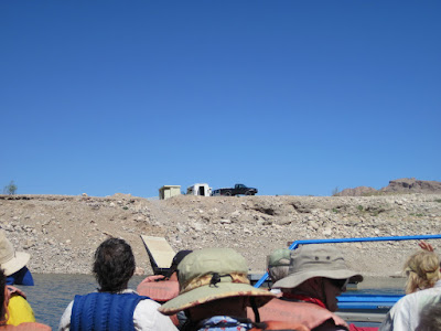
12:45 ramp reconstruction – lake lowered such that old ramp had to be extended; so we bypass and . . .
1245RampReconstructions_gc9t_001920.jpg

12:47 head to temporary takeout
1247OurTemporaryTakeout_IMG_2058.jpg
End Day 10
Day 10 from Spencer Canyon to Lake Mead (past mile 277 to around 300) and back to Flag
06:38 Last Breakfast in the Canyon for 2009 river trip
0638LastBreakfastInCanyon_gc9i_001249.jpg

06:43 Sunrise
0643LastSunrise2009GCtrip_IMG_1935.jpg

07:18After our final “Load the Boat” we head on downriver
0718StartingDOwnRiverGreatScenery_gc9i_001250.jpg

07:28 Reflecting on our last day AM Reflection
0728WeReeflectOnFinalAMReflection_gc9i_001261.jpg

08:46 Heron poses on sandbar
0846HeronPosesOnSandbar_gc9t_001685.jpg

Lots of chopper traffic today – quite noisy
08:51
0851Chpper1_gc9t_001689.jpg

08:52
0852Chpper2_gc9t_001692.jpg
08:54 chopper hangout
0854Chopper3Hangout_gc9t_001693.jpg

09:27 another chopper spot
0927Chopper4_IMG_1953.jpg

09:40 BA Shale
0940BAShale_gc9t_001703.jpg

09:46 Lake Mead deposits appear – note how eroded they are by lowered river channel – lake extended hundreds of yards to either side of current lower channel
0946LakeMeadDepositsDrodedBelowLimestoneCliffs_gc9t_001704.jpg

09:47 Side Canyon along one of many faults we cross today
0947SideCanyonAlongOneOfVariousFaultsWePass_gc9t_001705.jpg

09:48 BA Shale below Dolomite - detail
0948BAShaleExposureDetailBelowDolomite_gc9t_001706.jpg

09:51 Sky Bridge becomes visible up side canyon
0951SkyBridgeUpSideCanyon_gc9t_001720crop.jpg

11:03 Rounding last bend in canyon we see . . .
1103RoundingLastBendsWeRunOutOfCanyon_IMG_2020.jpg

11:20 we run out of canyon past Grand Wash cliffs
1120PastEndOfCanyon_IMG_2037.jpg

12:02 Jetboat is just ahead – a couple final shots on the raft – 1
1202Group1AlmostDone_IMG_2045.jpg

12:02 number 2
1202Group2AlmostDone_IMG_2047.jpg

Number 3
1203Group3AlmostDone_IMG_2048.jpg

Number 4 we bid farewell to our guides
1212Group4AlmostDoneUnloadTheBoat_gc9t_001804.jpg

12:12 In jetboat
1212InJetboat2_IMG_2050.jpg

12:13 casting off from Canyoneers raft
1213CastingOffFromCanyoneersRaft_IMG_2052.jpg

12:16 highly tilted strata typical of Iceberg Canyon – mostly Cambrian (rising up to Permian Toroweap and Kaibab)
1216HighlyTiltedStrataTypicalOfIcebergCanyon_gc9t_001811.jpg

12:20 looks like jetboat is headed straight towards a collision
1220JetboatMeetsCambrianStrata_gc9t_001816.jpg

12:29 panorama of tilted strata
1229PanoTiltedCambrianStrata_gc9t_001870.jpg

12:32 detail of iceberg canyon strata – note the bathtub ring where Lake Mead has dropped
1232DetailTiltedSTrataNoteBathTubRing_gc9t_001887.jpg

12:32 soon we run out of canyon and see Lake Mead open up ahead
1232LastPartCanyonLakeMeadAhead_gc9t_001888.jpg

12:38 there is just one last rapid; one big splash (and a big bang!)
1238OneBigSplashBigBangInLastRapid_gc9t_001904.jpg

12:40 ending a great trip
1240EndingGreatTrip_gc9t_001914.jpg

1240EndingGreatTrip2_gc9t_001915.jpg

12:45 ramp reconstruction – lake lowered such that old ramp had to be extended; so we bypass and . . .
1245RampReconstructions_gc9t_001920.jpg

12:47 head to temporary takeout
1247OurTemporaryTakeout_IMG_2058.jpg

End Day 10


