Eminence Break hike ahead. Eminence Break is a route formed by a massive landslide in the grand canyon - the first of several mega-slides we will see on our river trip.
Today we do a great EB hike, have lunch at Nankoweap (hiking up to the granaries) and travel to Carbon Camp at RM64.7 on river right.
Dinner is BBQ Chicken with a spicy veggie tofu option (which I tasted and it was great)
06:33 after waking up looking downriver to EB hike - Eminence Break is formed by a fault but the route is possible to hike due to a mega slide starting at the rim that extends most of the way down
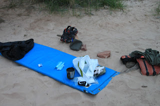
06:34 my campsite from night of Day 2 - nice location near the water
06:34 Chair circle used for breakfast
08:04 We eat, pack up and head downriver a couple hundred meters for our Eminence Break hike - nice river reflection starts the day
Below is a 2009 view of Eminence Break with more daylight showing the lower part of mega slide - our route contours from lower right to upper left - the break visible at upper left is the steepest portion of the trail. Overall, this is a good trail and getting better as more river trips do it.
08:49 view from first overlook - that is our tiny boat way down there!
08:50 Ed makes his way up from overlook
08:51 Jeff Eorio climbing EB
08:52 Kevin and Jeff at overlook
09:19 we arrive at our destination
09:20 Eorios
09:26
09:32 we waited for a groups of kayaks and paddle boats to go thru President Harding Rapid - here is 2nd kayak coming out
09:32 third kayak ready to enter
and exiting
09:41 group enjoying EB overlook
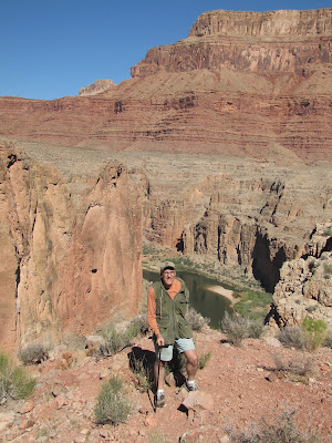
09:43 Even got a photo of myself - several trip members kindly operated my camera thruout the trip (I am grateful!)
10:25 we hike down and on the way notice this rock with worm cast fossils
11:01 as we proceed down the river we pass another party
11:01 very nice boat
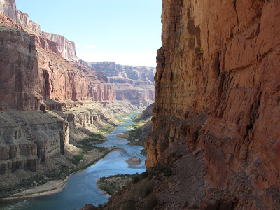
11:04 looking upriver at great scenery
John Zambrano provided next two photos of our canyoneers on the boat
11:42 river is low at 8000 cfs - see ducks below on sandbar - we are ducking sandbars for much of the trip
11:57 below Muav we see BA
12:10 heading towards Nankoweap Brandon talks about the area
12:11 We see Nankoweap Canyon entering on right - you can barely see the granaries on cliff to left of center
12:13 here is a zoom of the granaries
and a detail - look how far up the cliff these were - Anasazi had no trail and did this often
12:33 we stop for lunch and Beth, Kevin, Jeff and myself do a very fast hike up to the granaries - here is a view downriver from part way up what is a VERY steep trail
12:47 we arrive at the granaries
12:47 view downriver - this is a classic
12:48 see the tiny Philomena boat below in this zoom?
I had trouble myself - here is a max-zoom
12:49 climbing last bit to our destination
12:49 Nankoweap literally on cliff edge
12:50
12:53 Classic National Geo view
Jeff Eorio photo
13:02 view of another Nankoweap ruin
Jeff photo
Kevin enjoys Nankoweap
13:06 Bill at Nankoweap
Jeff and Kevin
we can spend only a couple minutes and soon head back - here is a photo of Kevin on the trail
and Beth
13:56 the group finished lunch and we pull away - the two on the beach had hiked down from the rim - we provided a couple beers and several soft-drinks as well as cold cuts and other goodies from our lunch box
13:58 a GREAT BA exposure
14:48 another nice one
14:49 a very nice day to be on the river!
15:13 we had been curious about how muddy the LCR would be - peering ahead we see it is MUDDY
15:14 nice shot of the mixing of the waters - but this silt laden water is also what we will be bathing in the rest of the trip
With the showing of the Tapeats Sandstone at Mile 59 we have now seen the last of the classic Grand Canyon sedimentary rock layers - Tapeats is the Time in our mnemonic - Know The Canyons History, Study Rocks Made By Time
15:21 Mile 59 RL Tapeats ledges below
18:00 Mile 65 view up river from Carbon Camp (which is on river right)
18:00 Philomena tied up at Carbon Camp with BBQ chicken cooking at far right
view behind the camp - we will be hiking here tomorrow AM early
a park service trip is running up and down the river tonight - they are shocking trout to try to reduce pressure on the endangered chub - I watch it for entertainment but soon nod off (years of swing shift work made me immune to anything interrupting my sleep)
15:43 we passed an exposure on river left (exact river mile coming but is low 50s) this is today's geology quiz


No comments:
Post a Comment