Sept 2009 Geology River Trip - Day 2 Part 1 Hike (Sept 14 Hike up Rider Canyon and downriver to RM34.8 Nautiloid Canyon)
This is a photo journal for the Rider Canyon hike we did early Sept 14.
Sept 13 (Day 1) we camped at Rider Camp (river mile 17 – river right) – positioning us for a hike up Rider Canyon.
To keep individual journal entries small enough for original email logs, there is a separate journal covering several hikes – the Rider Canyon had a number of interesting items and was a fun hike so got a separate entry.
We got up early by 06:00 (early for a first day), had breakfast, “loaded the boat” and hiked up Rider Canyon.
07:50 start of Rider Canyon hike
0750_gc9t_002287.jpg

Mark Combs photo as we cross the creek to get up high on creek left (creek left? River/creek side is based on looking in direction of flow and we are looking up the creek without a paddle here)
0840_MarkRiderCanyonHike_P9140059.jpg

07:58 Rider Canyon quickly becomes a typical GC slot hike - for the most part we avoided the creek as it running a mudflow
0758_gc9t_002293.jpg

0758_gc9t_002292resize.JPG

Some of us cannot resist the call of the mud . . .
0808_mud_gc9t_002312.jpg

08:09 mud falls
0809_gc9t_002316.jpg

Another mud falls at a pour off
0802_gc9t_002294.jpg

08:10 Bob Wyatt at a pour off in Rider Canyon
0808_gc9t_002315resize.jpg

Gosh – this canyon looks like a climbing opportunity – and it quickly becomes one for a number of folks
0809_gc9t_002305.jpg

0811_gc9t_002318.jpg

Mike climbing down
0813_gc9t_002325.jpg

Two Jims (both strong climbers)
0824_gc9t_002343.jpg

It was not all climbing – there were running opportunities – Suzette
0815_SuzzetteRuns_gc9t_002329.jpg

08:22 sacred datura is quite common in the Grand Canyon – this is one nice example from the Rider Canyon hike
0822_gc9t_002338.jpg

Wayne did discuss the Rider Canyon geology – thanks to Mark Combs for the below photo
0902_MarkCombsWayneSpeaksRiderCanyon_P9140071.jpg

08:37 our hike was all too brief and we exited the canyon, got on the boats and prepared to leave camp before 09:00
0837_gc9t_002350resize.jpg

08:40 reflections off the river as we got back to camp - fantastic!!
0840_gc9t_002353resize.jpg

End of Day 2 hike up Rider Canyon
The day 2 photos will be on Flickr
Flickr tip – You do not need an account on flickr - You can download any size photo from my flickr pro account. Without being logged in to an account, you can click on a photo, then on All Sizes, then on the size you wish – select “Download the blah size” and it will do it.
Subject: Sept 2009 Geology River Trip - Day 2 Part 2 Rider Camp to North Canyon (Sept 14 from Rider Canyon to Nauteloid Camp)
Day 2 we got up in Rider Camp at river mile 17, hiked Rider Canyon and moved on down river to Nautiloid Canyon where we camped.
There was a separate journal covering the Rider Canyon hike – it had a number of interesting items and was a fun hike so it got a separate entry.
Of course, we will during these 10 days be enjoying all the Grand Canyon rapids – here is a link to a list of all the Rapids.
These journals reference a number of camps my website links to a list of river camps for 2009 on the NPS site – this list includes the river mile, camp name along with some brief comments on size and use.
When we got to camp the prior night we setup in a rainstorm so it was not a huge surprise to see that Rider Canyon creek was running in the morning. This was more of a mudflow than a creek and we see in the photo below there was enough silt to color the Colorado river.
Mile17_0000_gc9s_006727resize.jpg

the very new moon meant we got dark skies for most of the night our whole trip – when the moon is bright it blocks out star gazing and even can make it difficult to sleep without eyeshades
for this whole trip we have dark skies during peak viewing time and great Milky Way views
Mile17_0620_gc9a_005203resize.jpg

We hiked Rider Canyon as covered in a separate journal – Wayne did talk about the geology during the hike and pointed out interesting items to folks as he hiked.
As we head down the river we saw some great early morning light and nice river reflections (below taken at 09:12)
0912_gc9s_006739.jpg

And specifically this very nice reflection at 09:17
0917_reflections_gc9s_006745.jpg

09:22 river mile 18.6 Boulder Narrows. Looking upriver at large Toroweap boulder in channel – note driftwood from old flood (122k cfs in 1957 – before Glen Canyon Dam)
This is the largest boulder seen in the river in Grand Canyon
0922_rockDriftwoodFromOldFlood_gc9t_002383.jpg

We hiked North Canyon at river mile 20.5 starting around 09:50
Did I mention it is an impressive canyon!
0952NC_gc9t_002406.jpg

09:50 of course we see more Sacred Datura (notice some open flowers and the three new buds that will open tonight to the left of four open ones)
0950NCSacredDatura_gc9t_002405.jpg

Enough of flora, how about some fauna
0952NCLizard_gc9t_002411.jpg

10:35 Wayne discusses geology at a break in North Canyon – he is sitting on Supai
1035NC_gc9t_002439.jpg

Wayne took this great photo of a root cast in the Supai
root cast discussed by Wayne (photo by Wayne)

0000WayneRider7RootCast.jpg
Wayne discussed exfoliation in this exposure of Esplanade sandstone. Note how the sandstone spalls parallel to the drainages - as the pressure from all the stone originally above is released by the erosion, the sandstone pops out to create these lines of weakness.
1017NCExfoliation_gc9t_002424.jpg

10:42 the pool we turned around at (there is a very high dry fall just beyond the pool) – thanks to Mark for shooting me with my Canon T1I
1048NCTurnArroundPool_gc9t_002459.jpg

I am glad to be here!

11:10 another root cast photo (from near mouth of North Canyon)
1110NCrootcast_gc9t_002467.jpg

11:25 river sediments deposited near mouth of North Canyon – there is a lot of fine detail in the full image
1125NC_gc9t_002471.jpg

End of Day 2 Part 2
Subject: Sept 2009 Geology River Trip - Day 2 Part 3 North Canyon to Nauteloid (Sept 14 from Rider Canyon to Nauteloid Camp) - revised with Google Earth map
Attachments: Sep14GPS1.kmz
This file is revised – several new images were added and selected images for Sept 14 are now provided in a Google Earth kmz file – these are the first output from the effort of Geotagging all images with GPS info.
If you have Google Earth installed on your computer you can run the attached file (by clicking on it). You can then click on Images under “Places” in Google Earth to see them on the map (you can see all images on the map by expanding the time range using the time slider depending upon your version of Google Earth). Tell me what you think as I am considering providing access to photos for all journals in a similar fashion.
The intent is to update all Flickr images with GPS tag information – this will allow you to let you place them on Google Earth using the standard Flickr integration.
Subject: Sept 2009 Geology River Trip - Day 2 Part 3 North Canyon to Nauteloid (Sept 14 from Rider Canyon to Nauteloid Camp) - revised with Google Earth map
Day 2 we got up in Rider Camp at river mile 17, hiked Rider Canyon and moved on down river to Nautiloid Canyon where we camped.
There was a separate journal covering the Rider Canyon hike as well as the trip to North Canyon and its hike – it this is part 3 of day 2 – a busy day as we will see.
We will during these 10 days be enjoying all the Grand Canyon rapids – here is a link to a list of all the Rapids.
These journals reference a number of camps my website links to a list of river camps for 2009 on the NPS site – this list includes the river mile, camp name along with some brief comments on size and use.
We finish our hike of North Canyon and proceed down the river
1144HeadOnDOwnTheRiver_gc9s_006772.jpg

11:52 we see Indian Dick rock ahead – this name is sourced from Nancy Brian’s “River to Rim: A Guide to Place Names Along the Colorado River in Grand Canyon from Lake Powell”
I highly recommend this book as the most complete source of place name information (with excellent inclusion of usgs vetted names). Here is a link to a free online list of some Grand Canyon place name information.
1152IndianDick_gc9t_002476.jpg

11:59 we see our first bighorn on this trip (three at one time – and we see many more thruout the trip) roughly river mile 24-25
1159FirstBighorn_gc9t_002485.jpg

12:00 the male bighorn poses for us
1200Bighorn_gc9t_002490.jpg

Terry did the first of several enlightening discussions of bighorn behavior – we are all grateful that he was on this trip and shared some of his extensive knowledge
12:35 around river mile 26 we stop at a solution cave – these are common in limestone deposits - here we get a chance to explore a fine example with Wayne explaining how they form
1235SolutionCave_gc9s_006808.jpg

Below photos supplied by Gary of us entering the cave and exploring it
1235SolutionCave_IMG_1941.JPG

1235SolutionCaveWayne_IMG_1943.jpg

13:18 lunch stop around Shinumo Wash (around river mile 29.5)
1318LunchSilverGrottoShinumoWash_gc9i_002632.jpg

14:07 our lunch spot gets a great view of a surfer attempting to run the grand canyon on a stand up paddle board (called SUPing)– this was being filmed and will show up on TV at some point – not certain who was doing this during our trip but I see on the web references to Laird Hamilton and Gerry Lopez as having done the Grand Canyon - 1407Surfer_gc9i_002673.jpg

14:11 Heron poses for us
1411Heron_gc9i_002694resize.jpg

14:12 river mile 30 we see the Fence Fault ahead on the right – the Supai is down dropped up to 200 feet where this fault crosses the river – you will see below where the Redwall cliff on river right (in center of photo) is followed by Supai Group down-dropped rocks
1412rm30FenceFault_gc9i_002697adj.jpg

14:39 red wall cavern appears ahead - it is much larger than it looks
1439RedwallCavernAppearsAhead_gc9i_002767.jpg

14:46 we stop and discuss the geology and fossil remains – we also play in the sand
1446RWCWeStopandPlayAndDiscussGeologyplusfossilremains_gc9i_002775.jpg

Bryozoan fossil in red wall cavern – contrast enhanced image to better show the fossil (and to use an infrequently used feature in my photo editing tool) - Bryozoans are tiny polyp-like animals that form small coral-like colonies.
1453fossilEnhanced_gc9i_002795.jpg

Another shot of Bryozoan fossils (and of Mike photographing using his Canon d10 – taken using my d10) Mike provided a number of tips on d10 adjustments including best white balance in the grand canyon
1503BryozoanMiked10ByMyd10_gc9s_006857.jpg

Detail of Bryozoan fossils including stalk – link to Wikipedia article
1504Bryozoan_gc9s_006858.jpg

We proceed downriver to Nautiloid camp and hike Nautiloid canyon RM 34.8 – this gets separate treatment in its own journal (next)
End of Day 2 Part 3
This is the final journal entry for day 2 of the Sept 2009 10 day raft trip of the Grand Canyon.
In the last journal we looked at some of the fossils we saw in red wall cavern - here is a link to a brief discussion of some fossils found in the Grand Canyon (aimed at Kaibab Limestone in the GC village area but we saw many of these on our trip of the whole of the grand). The Bryozoan fossils in particular span from the Redwall Limestoneup to the Kaibab in the canyon (and in fact Bryozoans exist in various forms today).
Here is a photo of Stanton's Cave we passed/looked at just before our stop at red wall cavern 14:30

Here is an enhanced image showing the bat gate constructed to keep people out while allowing the bats continued access
Here is a link to a discussion of the bat gate construction (which is well worth a read)

15:30 Nautiloid Canyon - our campsite and last hike for a busy Day 2

We stop and setup camp at around 15:30
Once camp is setup we hike Nautiloid Canyon - we start with a climb up a broken limestone cliff - here is Cindy Combs climbing up at 16:57

Here is a view from the top of the cliff of our campsite

Why did we climb here - to see the Nautiloid Fossils

Another fine example

And this one enhanced

These fossils are found in the redwall limestone (Whitmore Wash member) and are very extensive from Marble Canyon to Frenchman Mountain near Las Vegas
Here is a nice discussion of Nautiloids
We climb back down the cliff

Back at our camp - the obligatory photo of the duke:

And scenery

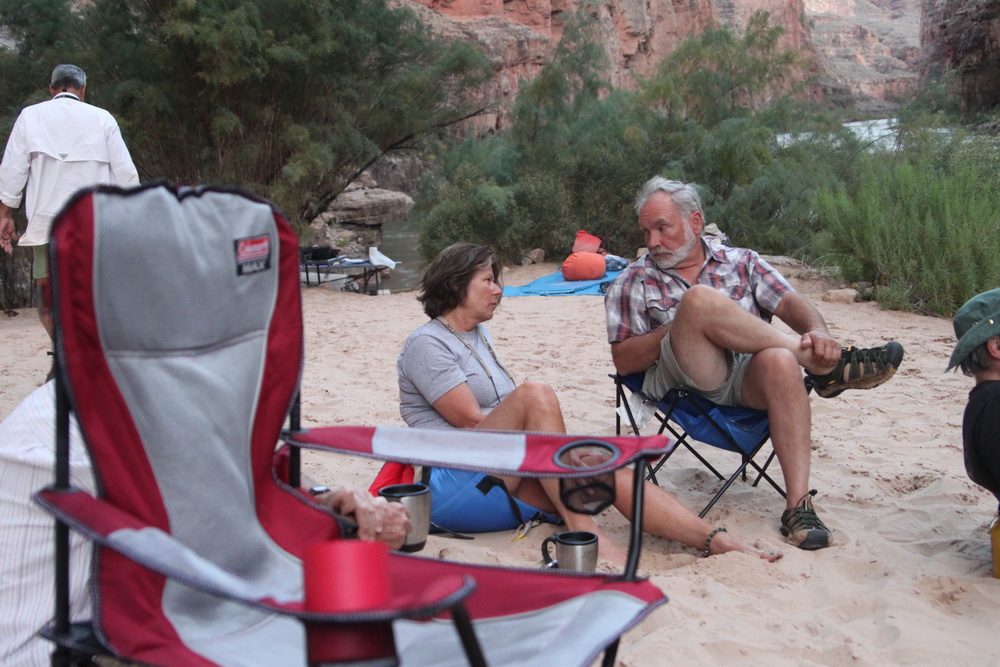
Folks relaxing in the chair and sand circle:


All done with Day 2 - honest!
End of Day 2
There was a separate journal covering the Rider Canyon hike – it had a number of interesting items and was a fun hike so it got a separate entry.
Of course, we will during these 10 days be enjoying all the Grand Canyon rapids – here is a link to a list of all the Rapids.
These journals reference a number of camps my website links to a list of river camps for 2009 on the NPS site – this list includes the river mile, camp name along with some brief comments on size and use.
When we got to camp the prior night we setup in a rainstorm so it was not a huge surprise to see that Rider Canyon creek was running in the morning. This was more of a mudflow than a creek and we see in the photo below there was enough silt to color the Colorado river.
Mile17_0000_gc9s_006727resize.jpg

the very new moon meant we got dark skies for most of the night our whole trip – when the moon is bright it blocks out star gazing and even can make it difficult to sleep without eyeshades
for this whole trip we have dark skies during peak viewing time and great Milky Way views
Mile17_0620_gc9a_005203resize.jpg

We hiked Rider Canyon as covered in a separate journal – Wayne did talk about the geology during the hike and pointed out interesting items to folks as he hiked.
As we head down the river we saw some great early morning light and nice river reflections (below taken at 09:12)
0912_gc9s_006739.jpg

And specifically this very nice reflection at 09:17
0917_reflections_gc9s_006745.jpg

09:22 river mile 18.6 Boulder Narrows. Looking upriver at large Toroweap boulder in channel – note driftwood from old flood (122k cfs in 1957 – before Glen Canyon Dam)
This is the largest boulder seen in the river in Grand Canyon
0922_rockDriftwoodFromOldFlood_gc9t_002383.jpg

We hiked North Canyon at river mile 20.5 starting around 09:50
Did I mention it is an impressive canyon!
0952NC_gc9t_002406.jpg

09:50 of course we see more Sacred Datura (notice some open flowers and the three new buds that will open tonight to the left of four open ones)
0950NCSacredDatura_gc9t_002405.jpg

Enough of flora, how about some fauna
0952NCLizard_gc9t_002411.jpg

10:35 Wayne discusses geology at a break in North Canyon – he is sitting on Supai
1035NC_gc9t_002439.jpg

Wayne took this great photo of a root cast in the Supai
root cast discussed by Wayne (photo by Wayne)

0000WayneRider7RootCast.jpg
Wayne discussed exfoliation in this exposure of Esplanade sandstone. Note how the sandstone spalls parallel to the drainages - as the pressure from all the stone originally above is released by the erosion, the sandstone pops out to create these lines of weakness.
1017NCExfoliation_gc9t_002424.jpg

10:42 the pool we turned around at (there is a very high dry fall just beyond the pool) – thanks to Mark for shooting me with my Canon T1I
1048NCTurnArroundPool_gc9t_002459.jpg

I am glad to be here!

11:10 another root cast photo (from near mouth of North Canyon)
1110NCrootcast_gc9t_002467.jpg

11:25 river sediments deposited near mouth of North Canyon – there is a lot of fine detail in the full image
1125NC_gc9t_002471.jpg

End of Day 2 Part 2
Subject: Sept 2009 Geology River Trip - Day 2 Part 3 North Canyon to Nauteloid (Sept 14 from Rider Canyon to Nauteloid Camp) - revised with Google Earth map
Attachments: Sep14GPS1.kmz
This file is revised – several new images were added and selected images for Sept 14 are now provided in a Google Earth kmz file – these are the first output from the effort of Geotagging all images with GPS info.
If you have Google Earth installed on your computer you can run the attached file (by clicking on it). You can then click on Images under “Places” in Google Earth to see them on the map (you can see all images on the map by expanding the time range using the time slider depending upon your version of Google Earth). Tell me what you think as I am considering providing access to photos for all journals in a similar fashion.
The intent is to update all Flickr images with GPS tag information – this will allow you to let you place them on Google Earth using the standard Flickr integration.
Subject: Sept 2009 Geology River Trip - Day 2 Part 3 North Canyon to Nauteloid (Sept 14 from Rider Canyon to Nauteloid Camp) - revised with Google Earth map
Day 2 we got up in Rider Camp at river mile 17, hiked Rider Canyon and moved on down river to Nautiloid Canyon where we camped.
There was a separate journal covering the Rider Canyon hike as well as the trip to North Canyon and its hike – it this is part 3 of day 2 – a busy day as we will see.
We will during these 10 days be enjoying all the Grand Canyon rapids – here is a link to a list of all the Rapids.
These journals reference a number of camps my website links to a list of river camps for 2009 on the NPS site – this list includes the river mile, camp name along with some brief comments on size and use.
We finish our hike of North Canyon and proceed down the river
1144HeadOnDOwnTheRiver_gc9s_006772.jpg

11:52 we see Indian Dick rock ahead – this name is sourced from Nancy Brian’s “River to Rim: A Guide to Place Names Along the Colorado River in Grand Canyon from Lake Powell”
I highly recommend this book as the most complete source of place name information (with excellent inclusion of usgs vetted names). Here is a link to a free online list of some Grand Canyon place name information.
1152IndianDick_gc9t_002476.jpg

11:59 we see our first bighorn on this trip (three at one time – and we see many more thruout the trip) roughly river mile 24-25
1159FirstBighorn_gc9t_002485.jpg

12:00 the male bighorn poses for us
1200Bighorn_gc9t_002490.jpg

Terry did the first of several enlightening discussions of bighorn behavior – we are all grateful that he was on this trip and shared some of his extensive knowledge
12:35 around river mile 26 we stop at a solution cave – these are common in limestone deposits - here we get a chance to explore a fine example with Wayne explaining how they form
1235SolutionCave_gc9s_006808.jpg

Below photos supplied by Gary of us entering the cave and exploring it
1235SolutionCave_IMG_1941.JPG

1235SolutionCaveWayne_IMG_1943.jpg

13:18 lunch stop around Shinumo Wash (around river mile 29.5)
1318LunchSilverGrottoShinumoWash_gc9i_002632.jpg

14:07 our lunch spot gets a great view of a surfer attempting to run the grand canyon on a stand up paddle board (called SUPing)– this was being filmed and will show up on TV at some point – not certain who was doing this during our trip but I see on the web references to Laird Hamilton and Gerry Lopez as having done the Grand Canyon - 1407Surfer_gc9i_002673.jpg

14:11 Heron poses for us
1411Heron_gc9i_002694resize.jpg

14:12 river mile 30 we see the Fence Fault ahead on the right – the Supai is down dropped up to 200 feet where this fault crosses the river – you will see below where the Redwall cliff on river right (in center of photo) is followed by Supai Group down-dropped rocks
1412rm30FenceFault_gc9i_002697adj.jpg

14:39 red wall cavern appears ahead - it is much larger than it looks
1439RedwallCavernAppearsAhead_gc9i_002767.jpg

14:46 we stop and discuss the geology and fossil remains – we also play in the sand
1446RWCWeStopandPlayAndDiscussGeologyplusfossilremains_gc9i_002775.jpg

Bryozoan fossil in red wall cavern – contrast enhanced image to better show the fossil (and to use an infrequently used feature in my photo editing tool) - Bryozoans are tiny polyp-like animals that form small coral-like colonies.
1453fossilEnhanced_gc9i_002795.jpg

Another shot of Bryozoan fossils (and of Mike photographing using his Canon d10 – taken using my d10) Mike provided a number of tips on d10 adjustments including best white balance in the grand canyon
1503BryozoanMiked10ByMyd10_gc9s_006857.jpg

Detail of Bryozoan fossils including stalk – link to Wikipedia article
1504Bryozoan_gc9s_006858.jpg

We proceed downriver to Nautiloid camp and hike Nautiloid canyon RM 34.8 – this gets separate treatment in its own journal (next)
End of Day 2 Part 3
This is the final journal entry for day 2 of the Sept 2009 10 day raft trip of the Grand Canyon.
In the last journal we looked at some of the fossils we saw in red wall cavern - here is a link to a brief discussion of some fossils found in the Grand Canyon (aimed at Kaibab Limestone in the GC village area but we saw many of these on our trip of the whole of the grand). The Bryozoan fossils in particular span from the Redwall Limestoneup to the Kaibab in the canyon (and in fact Bryozoans exist in various forms today).
Here is a photo of Stanton's Cave we passed/looked at just before our stop at red wall cavern 14:30

Here is an enhanced image showing the bat gate constructed to keep people out while allowing the bats continued access
Here is a link to a discussion of the bat gate construction (which is well worth a read)

15:30 Nautiloid Canyon - our campsite and last hike for a busy Day 2

We stop and setup camp at around 15:30
Once camp is setup we hike Nautiloid Canyon - we start with a climb up a broken limestone cliff - here is Cindy Combs climbing up at 16:57

Here is a view from the top of the cliff of our campsite

Why did we climb here - to see the Nautiloid Fossils

Another fine example

And this one enhanced

These fossils are found in the redwall limestone (Whitmore Wash member) and are very extensive from Marble Canyon to Frenchman Mountain near Las Vegas
Here is a nice discussion of Nautiloids
We climb back down the cliff

Back at our camp - the obligatory photo of the duke:

And scenery

Folks relaxing in the chair and sand circle:

All done with Day 2 - honest!
End of Day 2
No comments:
Post a Comment