Wednesday, December 29, 2010

2008 Day 10 - Sept 22 mile 215.6-225 Diamond Creek

Day 10 - Sept 22 mile 215.6-225 Diamond Creek

Last Day - and another great place to wake up

Mile 216 we camped adjacent to this lava flow overlaying old river gravels and Tapeats


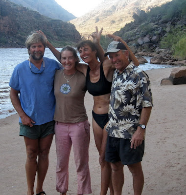
Our totally fantastic AZRA team (Ed, Cassey, Louise, Rob) they rock (had to have a geology connection for this geology log)

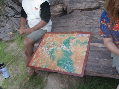
Last Geology talk by Wayne - focus is on the upcoming Hurricane Fault plus impact of volcanism in this part of the canyon


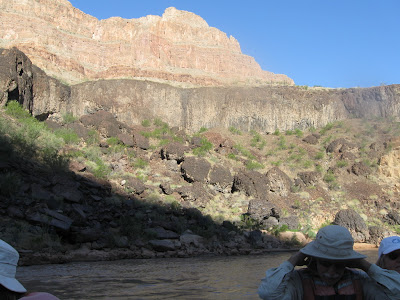
Mile 216 08:43 area - impact of lava/volcanism remains clear


09:01


09:09


Mile 220 09:15 eroded Diamond Creek pluton in mid channel - we see this periodically until we pull out


Mile 222.8 09:36 Diamond Peak ahead - Redwall Limestone forms the peak with Proterozoic rocks visible at river level


09:43


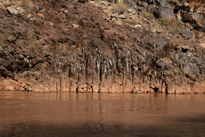
Mile 226 09:46 fluting in granitic rocks of the Diamond Creek pluton - this forms the walls just before Diamond Creek and is part of the Ruby Creek Superunit


All things come to an end and we leave the river at Mile 225 (group photo below was actually taken 9/15)


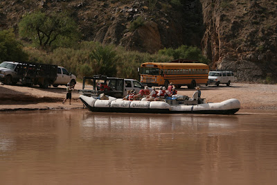
End of Part 1 - Day 10 is done, 2008 river trip is over


2008 Day 9 - Sept 21 mile 175.9 - 215.6 Opposite 3 Springs Camp Lava

Day 9 - Sept 21 mile 175.9 - 215.6 Opposite 3 Springs Camp Lava

Another beautiful camp to wakeup in

The moon provided early light

I woke up early and quickly figured out it must be Lava Day


Wayne's talk is about how lava dominated this part of the canyon


Talk done we hit the river and soon we see blocks of eroded lava

Mile 177.8 we approach a part of the canyon with numerous faults and associated lava flows created the scenery - in places it literally filled the canyon, was eroded, refilled - multiple times - and in other places more dikes of lava are seen


Mile 178 09:27 One lava pipe even erupted in the river and the remnant is named Vulcan's Anvil  -
 a dike can be seen to the side of the river.  These were all parts of the feeder system supplying volcanoes above.


09:45 approaching Lava Falls

09:47 Lava flows dominate the scenery - in places it literally filled the canyon

10:05 classic structure of slowly cooled basalt topped by a portion that cooled more quickly


10:23 here lava  flowed into the canyon from above


Mile 183.5 (approx) 10:35 great example of basalt columnar jointing - Wayne discussed at some length


Mile 186 10:37 we see remnants of volcanoes on the rim above  large flows ahead large cone is at Mile 187

Mile 189 schist island


Mile 187 detail of some of the jointing and flows


Mile 187.5 old channel filled with lava - this is part of the ancient Whitmore Wash (different angle than below)


Mile 188 view back upstream towards the ancient Whitmore Wash


Mile 196 12:00 Frogy Fault or Below Frogy lunch spot scenery


Mile 204.5 Below Spring Canyon Camp


Mile 212.9 14:54 Pumpkin Spring


As we approach our last camp site we see a great lava exposure - here the flow went down the old river on top of river gravels and Tapeats.  Later erosion of a new river channel cut thru these layers exposed here


Another angle with a better view of same exposure

Last camp on the river - Opposite Three Springs


End of Part 1 - Day 9 is done


2008 Day 8 - Sept 20 mile 151.3-175.9 Below Red Slide Camp

Day 8 - Sept 20 mile 151.3-175.9 Below Red Slide Camp part 1

Day 8 passing Ledges - this was a nice boulder field to hike thru - river is still red but is just starting to clear


Mile 152ish we pass a nice waterfall in the Muav at river edge - from the debris we can see even this little pouroff feeds boulders and sediment into the river


Mile 153.5 08:22 Sinyella Rapid


Mile 154 this was a beautiful day - and one of the clearest I have seen in the Grand Canyon - I believe air clarity was as good as I have seen in a looong time


Mile 154.8 rockfall in Muav Groge created island in mid river


Detail at lower right of Muav pouroff - note someone left the shower running


Mile 155 Louise convinced me this was a great way to experience the river trip - and she was RIGHT!  Muav Gorge was grand

Mile 156.2 Havasu Rapid and Canyon is just around the bend ahead


Mile 156.7 09:00 We tie up to the Muav ledges for our hike into Havasu Canyon


End of Part 1 - Day 8 continued


While hiking as usual I just post the time as it is all around river mile 156.7 we walk back a bit to enter Havasu Canyon


09:11 we get our first look into Havasu Canyon


09:12 the mixing of the waters . . .


09:15 we turn the corner and this is a magical place


09:18 We cross the creek (with care)

09:22 A little easy hiking


09:40 And an easy climb or two


And we reach the motor pool and spread out and enjoy a couple hours

Lounging around

In this paradise


Rob knows the best places


All so soon it's time to head back


And head on down river


End of Part 2 - Day 8 to be continued


3rd and final part for day 8 - we head downriver after spending a few hours hiking Havasu Canyon (3 hours and 35 minutes but who watches time in the GC)

12:30 Rob climbs up to remove a mooring rope


Mile 157 And we head down river

to a lunch spot around First Chance


Ed scouts then climbs up a pouroff to see what lies above


It was a pretty spot


We head downriver again

Enjoying the ride as we pass small camps


And big horn


Great scenery


Mile 175 Red Slide is a landslide in the Supai


Rubble towers protected from erosion by capstones


Detail showing the capstones


View from Below Red Slide Camp


Chair Circle in Below Red Slide Camp


Groover view - one of the best


End of Part 3 - Day 8 is done